• Olympic countdown - Reasons for a London Cycle Map, #17. It's a work of genius – just ask the confederacy of dunces!

    #17. IT'S A WORK OF GENIUS - JUST ASK THE CONFEDERACY OF DUNCES! I’ve often wondered whether Simon Parker’s London Cycle Map deserves to be counted as a work of genius or just a bloody good idea.

    As with most terminological debates, consensus doesn’t really matter – what matters is the brilliance of Parker’s breakthrough. In a stroke of astonishing insight, he has shown how to create a navigable network out of a sprawling labyrinth of cycle routes in London. If we sign and mark the streets of the current London Cycle Network in accordance with Parker’s routes, cyclists could get from anywhere to anywhere in the whole capital, safely and simply, by following just a few trails of colour.

    My opinion is that in distilling such beautiful and useful simplicity out of such ravaging complexity, Parker’s pioneering, bolt-from-the-blue accomplishment deserves to be counted as a work of genius.

    There is also a mischievous reason to think so. Jonathan Swift once said that “when a true genius appears in the world, you may know him by this infallible sign: that the dunces are all in confederacy against him”. It does indeed appear that Parker has been treated this way.

    Whether by the authorities, the mass-media, the general public, or even Britain’s major cycle advocacy groups, there is a rather sinister indifference being perpetrated against Parker's London Cycle Map.

    Occasionally this indifference manifests itself in flippant and clichéd criticisms which, far from strengthening or undermining Parker’s idea as one would expect criticism to achieve, just bounce annoyingly off the surface like midges.

    Mostly, though, the indifference equates to Parker’s idea simply being ignored – through a maddening silence, a burying of heads, or a stubborn continuation of flawed existing policies or proposals.

    The dunces who are in confederacy against Parker are making his wonderful plan all the more difficult to realise, especially given that his London Cycle Map is being overlooked by cycle advocacy groups, who ought, at the very minimum, to give it a fair hearing.

    But at least the confederacy of dunces is a sign of the ingenuity of Parker’s London Cycle Map. As ever, the good will out in the end.

    www.petition.co.uk/london-cycle-map-campaign

  • Olympic countdown - Reasons for a London Cycle Map, #18. Habitat corridors for cyclists.

    #18. HABITAT CORRIDORS FOR CYCLISTS. Country roads, tow-paths, parks, and the streets of Copenhagen; some habitats are perfect for cycling. Others are less so - and, alas, that includes London’s busiest streets, which heave with traffic, pollution and aggression.

    Unfortunately, such inhospitable habitats put off most would-be cyclists, and prevent a mass cycling migration from occurring daily in London.

    A similar problem can affect the migratory behaviour of animal species, which need to move among a range of natural environments – e.g. wetlands, pastures, burrowing sites, breeding grounds, prey habitats – to flourish. Urbanisation creates blockages which restrict or prevent animal migration.

    Conservationists often address this problem by creating ‘habitat corridors’ – strips of ecologically suitable land which criss-cross urbanized areas and provide a passage for migrating species from one environment to another.

    Something similar is needed for cyclists in London. Whereas we can’t realistically hope to make all cycling blockages such as major roads and junctions cycle-friendly (despite what the LCC’s Go Dutch campaign is claiming), we can provide corridors of safe cycling which criss-cross the capital.

    Sustrans have taken this lesson literally and signed a bunch of Greenways, that is, cycling corridors made out of strips of non-urban land in London. The problem is, there aren’t enough already existing green strips to make a comprehensive network of cycling corridors in London.

    TfL, in contrast, have rather missed the point of a habitat corridor for cycling. Through the Cycle Superhighways scheme, they have daubed miles of blue paint along major roads in London. Yet would-be cyclists are still understandably scared of those roads. TfL’s policy is equivalent to painting green lines through a city centre and expecting a neat procession of terrified animals to migrate along it.

    If we can’t make a network of urban cycling corridors out of greenways or highways, how else can we?

    The answer is staring us in the face: The London Cycle Network, or ‘LCN’, which has been developed over the last thirty years, at a cost of hundreds of millions of pounds. There are around 2000 kilometres of cycle routes on the LCN. These routes mostly involve safer, quieter streets, provisioned with cycle lanes and other useful cycling infrastructure improvements.

    The only problem with the LCN is that it is made up of an extremely complex tangle of routes that lacks a decent map and signage, and so is more or less impossible to navigate.

    Simon Parker’s London Cycle Map has offered a solution to these problems. He has imagined the LCN as a series of long straight, coloured routes which dissect the whole capital comprehensively, from every one of its regions to every other. By providing road markings and signs corresponding to these routes, we could enable cyclists to get from anywhere to anywhere in London by following a coloured trail, like on the Tube.

    In doing so, we would provide a vast and wonderful network of habitat corridors for cycling in London. Wherever cyclists wanted to go, they could get there safely on the routes of the LCN, insulated mostly from the main roads and terrifying junctions which for so long have blocked off would-be cyclists.

    Don’t believe the hype: with just 2% of journeys in the capital undertaken by bicycle, cyclists are an endangered species here. Let’s help them flourish, on the corridors of a London Cycle Map.

    www.petition.co.uk/london-cycle-map-campaign

  • Olympic countdown - Reasons for a London Cycle Map, #19. Avoiding a tragedy of the commons.

    #19. AVOIDING A TRAGEDY OF THE COMMONS. The current transport situation in London is a ‘tragedy of the commons’. To understand what this crucial phrase means, a little explanation is necessary.

    In a famous essay published in 1968, the biologist Garett Hardin coined the phrase ‘tragedy of the commons’ in order to describe the process by which shared pastures are prone to overgrazing. The problem, he noted, is that any farmer using common land perceives that he can benefit by allowing his animals to eat as much of the vegetation as possible (and by grazing as many animals as possible). But soon the land’s limited resources are at risk of depletion, leaving nothing for anyone. This is the worst outcome for the farmers, yet each of them can be led to contributing to its eventuality by a compelling chain of reasoning.

    Imagine you are a farmer with a decision to make about whether or not to restrict your animals’ grazing. If you don’t restrict them, you stand to gain, whatever everyone else does: if everybody else restricts their animals and you don’t, you’ll get a bigger share of the land’s resources; and if nobody restricts their animals and you don’t, you’ll still get a bigger share of the land’s resources than you would have done through exercising restraint. The ‘tragedy’ occurs when every farmer makes this calculation, so that the land, and each and every one of them, ends up worse off than if the commons hadn’t been exploited.

    Hardin’s description isn’t just applicable to farmers. All kinds of groups can get locked into a permanently suboptimal state of functioning whenever their members reckon that it’s in their interests to succumb to the temptation of anti-social behaviour.

    London’s transport situation provides another example. Every day millions of Londoners use their cars for commuting, doing the shopping, taking the kids to and from school, and numerous other errands – the capital is a big place, and there’s no time to waste. But it’s not that big, certainly not enough to contain all those cars. Rather than cruising round an airfield or a Swiss mountain bend – what people imagine they’re signing up for when buying a car – driving in London is more like moving furniture in a bedsit. The traffic is jammed in a frenzy of beeping, road rage, revving and fumes, with hardly a parking space in site, while crack-squads of commission-paid traffic wardens stalk the pavements slapping £120 fines on windscreens. Dystopia is putting it mildly.

    Driving in London (and most other urban spaces) is tragic insofar as road users calculate that, whatever everyone else does, using the car is a better option than walking or cycling. The reckoning is: if the minority drives then it’s quicker and better to take the car; and if the majority drives then it’s still better to take the car because congested streets are too terrifying and polluted for cycling or walking on. The upshot is the furious gridlock familiar to anyone who has driven on, say, the North Circular in rush-hour.

    And, worse, it’s not just the participants in the tragedy who are involved. For one thing, everyone in London is affected negatively. Because car-filled streets are unpleasant and dangerous, especially for vulnerable residents such as children and senior citizens, wider society ends up paying for the consumer habit of one segment. Cars are also less sociable: they seclude their occupants behind windscreens, thus decreasing the sense of community and making everyone worse off.

    Another especially bad thing about the tragedy of the commons car drivers cause is that it enables a segment of society to devilishly benefit from the tragic behavior of others. Specifically, producers of cars are the beneficiaries, making money on the back of that compelling chain of reasoning which leads Londoners to buy a car despite the collective harms. As a society we are therefore compromised doubly: our suffering is a cohort’s gain.

    How do we break out of London’s transportation tragedy of the commons? An obvious answer is to get more people cycling. This could be achieved in part by convincing vast numbers of Londoners of the health, financial and well-being benefits of cycling, but most importantly by insisting that the traffic on the capital’s streets only seems to be too dangerous for cycling. In recent years, many cyclists have woken up to the fact that cycling is perfectly safe if you take care and ride sensibly (don’t undertake vehicles turning left, for instance). The problem is, these cyclists are very much in the minority. Most Londoners remain adamant that the traffic makes it too dangerous to cycle, so they take their cars instead. And so the tragedy persists. Traffic is the fear of traffic incarnate.

    Simon Parker’s London Cycle Map offers a realistic way of side-stepping this tragedy of the commons. His plan shows how we could install road markings and signs on the streets of the London Cycle Network (which are generally safer and quieter), enabling would-be cyclists to get from anywhere to anywhere in the capital by following just a few coloured routes, like on the Tube. This would remove the fear-factor associated with cycling, because the terrifying traffic on the capital’s major roads would mostly be an irrelevance on the routes of the London Cycle Map.

    After experiencing the benefits of cycling using Parker’s London Cycle Map, millions of Londoners would soon lose the temptation to slip back into their car driving ways. But, even if they did slip back occasionally, this wouldn’t impact on others’ decision whether or not to cycle. The routes of the London Cycle Map would mostly be insulated from the dynamic of fear which causes cars to proliferate in urban spaces. (In contrast, the LCC's Go Dutch campaign is promising only to insulate a few segments of main road, which would still leave cyclists exposed to fear for most of their journeys.)  

    Tragedies of the commons can be solved only when all the participants or their representatives agree to take steps to avoid the tragedy. Farmers, for instance, can co-operate to keep land sustainable, or – in another example – fishermen can co-operate to avoid depleting fisheries.

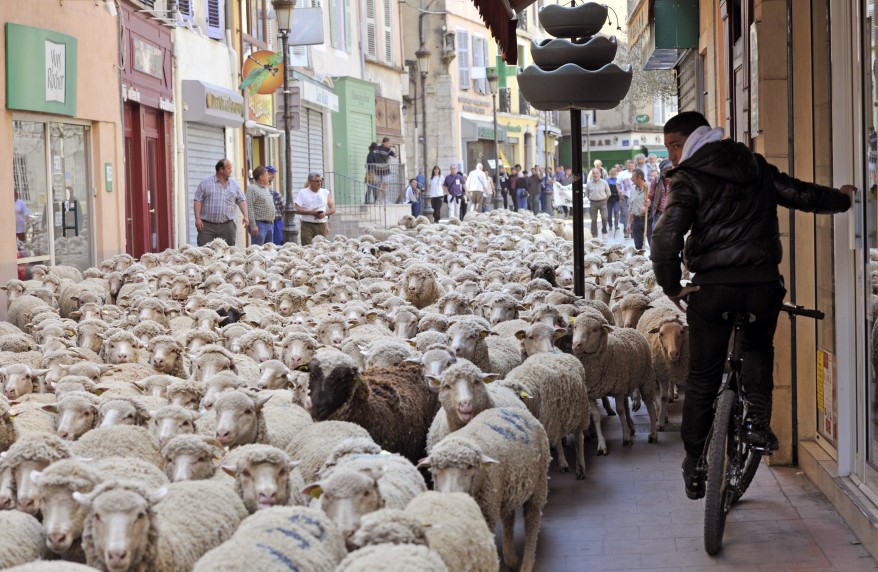
    In order to solve the transport tragedy of the commons in London we need the authorities to co-operate, by signing and marking the thousands of kilometres of safe cycling streets making up the London Cycle Network with the routes featured on Parker’s London Cycle Map. Alas, our political leaders and civil servants don’t seem to be interested. So the rest of us will have to stop being sheep, and start demanding the solution.

    www.petition.co.uk/london-cycle-map-campaign

  • Olympic countdown - Reasons for a London Cycle Map, #20. London's True Colours.

    #20. LONDON'S TRUE COLOURS. London looks great from a bike.

    That’s the first line of ‘London’s True Colours’, the film for the London Cycle Map Campaign. And it’s true. There are so many wonderful scenes to take in by bike in the capital – the glow of the South Bank reflected in the Thames at night, the technicolour treasure-trove of Portobello Market, the silver gleam of the cityscape against the greenery of Hampstead Heath…

    The trouble is, cyclists are often too busy concentrating on navigating to be able to appreciate London’s scenery – whether they’re monitoring street names or following a list of hundreds of turn-rights and turn-lefts, or staring at the greasy screen of a smartphone.

    ‘London’s True Colours’ is all about Simon Parker’s ingenious London Cycle Map, which, with proper signage to back it up, would enable cyclists to get from anywhere to anywhere in the capital simply by following just a few long, straight, coloured routes, like on the Tube.

    You can view the film on youtube, facebook or on the homepage of cyclelifestyle.co.uk. Please share it with your friends if you like it!

    With your help, we can deliver a London Cycle Map, and make the capital a place that’s as simple as it is beautiful to cycle in.

    www.petition.co.uk/london-cycle-map-campaign

  • Olympic countdown - Reasons for a London Cycle Map, #21. Telling it like it is.

    #21. TELLING IT LIKE IT IS. In an astonishing exaggeration, the LCC announced today: ‘Mayor tells Transport for London to Go Dutch’.

    He did nothing of the sort! Boris Johnson sent a letter to the LCC which vaguely waffled about mandates, jobs, modernisation and task forces, then added this:

    “I have asked TfL to review the “Go Dutch” campaign to ascertain how the principles it establishes can be incorporated into the design and implementation of cycling schemes in London, taking into account the UK legal framework and regulations, the physical constrains of London’s streets, and the needs of all road users.”

    Hallelujah, a review! A review which will take into account the ‘physical constraints of London’s streets’ (which I have previously drawn attention to) and ‘the needs of all road users’ (which I have also drawn attention to), and will no doubt conclude that there is scope for approximately... three new Go Dutch schemes on main roads this mayoralty, just as the LCC ‘demanded’.

    Can I be the first to say what a waste of money this whole pantomime is?

    I don’t know the exact budgets of TfL and the LCC, but TfL is spending over a hundred million pounds on the Cycle Superhighways alone (so basically its cycling budget is enormous), while the LCC boasts around 11,000 members who pay (a maximum rate of) £34 per annum, and it receives funding from charitable grants, TfL and local authorities, as well as through ad revenue from its website and the London Cyclist magazine.

    And for all this investment, what's the best that the LCC and TfL can come up with? Respectively, a marketing-led proposal to make London more like Holland and a review of that proposal – a proposal which, even if successful, would require centuries to turn London into a cycling city.

    The best thing the LCC has come up with is their ‘Love London’ slogan – and that was presumably inspired by Cycle Lifestyle's (without any acknowledgement of our magazine or of the work we have put into distributing 90,000 free cycling magazines in London over the last three years).

    The saddest thing is, there will be no outcry. The LCC’s members will diligently record onto a new interactive map the locations of London’s most dangerous cycling roads and junctions (as if TfL doesn’t already know where they are), and TfL will diligently decline to upgrade the cycling infrastructure on the vast majority of those roads and junctions because of the ‘physical constraints of London’s streets’ and the ‘needs of all road users’.

    And while those LCC members fiddle around with their smart phones – inputting data and feeling empowered – the internet will suck up their enthusiasm like the perfect totalitarian sponge.

    With the combined money and manpower of TfL and the LCC, not to mention their members, we could, by now, have fitted out the London Cycle Network to a truly world-class standard. The thirty years of investment which have already gone into that network could have been built on, to create the brilliant system of long, straight routes depicted on Parker’s London Cycle Map. Any remaining dodgy parts of the network could have been developed many times over, and Londoners could then have ridden from anywhere to anywhere in the capital on safer, quieter streets, following just a few coloured routes, like on the Tube.

    Instead, we’ve got a marketing blitz promising to make London more like Holland, three new cycle schemes at a time.

    At that rate, the only way London is going to end up like Holland is when they’re both under water due to global warming.

    www.petition.co.uk/london-cycle-map-campaign

  • Olympic countdown - Reasons for a London Cycle Map, #22. Creating the political will for cycle development.

    CREATING THE POLITICAL WILL FOR CYCLE DEVELOPMENT. #21. A London Cycle Map would do wonders for solving the twin problems of navigation and safety that are currently putting off most would-be cyclists in the capital.

    By marking and signing the roads of the London Cycle Network with the long straight routes shown on Parker’s map, the authorities could enable cyclists to get from anywhere to anywhere in London, safely and simply, by following just a few coloured routes, like on the Tube.

    The London Cycle Network is big enough to accommodate tens of millions of cycle journeys each day. Nevertheless, once millions of cyclists start using the network, they would soon spread out onto the surrounding streets and beyond. Confidence begets confidence: by giving would-be cyclists a safe-haven in which they can hone their skills, the London Cycle Map would help to cyclise the whole capital.

    Most importantly, this would have the effect of rousing the political will to deliver further cycle development in London. By giving the masses a taste of cycling on the well-provisioned London Cycle Network, we would whet their appetites for more cycle development, both on the network and elsewhere.

    In the long run, the ideal scenario would be to create a capital city where as many streets as possible are good for cycling. Of course, even in the ideal scenario, the London Cycle Map would remain useful: it would be the perfect way to introduce newcomers to cycling. Its role would mirror that of the bicycle itself during and after the rapid industrialisation which occurred at the end of 19th century – when the bicycle went from being a widespread transport necessity, one which catalysed progress, to an optional utility.

    Compare this ‘catalysing’ kind of cycle development to the London Cycling Campaign’s recent call for cyclists to identify, on an interactive map, ‘areas of London that would benefit from being given a street design that's more cycling and people-friendly’. Obviously all this data-inputting will make LCC members feel empowered (‘feel’ being the crucial word) and will doubtless throw up countless areas for improvement, but, sadly, very little will come of the project, for a simple reason:

    The car drivers, van drivers, cab drivers and truck drivers – the very same people whose presence makes many of London’s roads and junctions so dangerous for cyclists – are a much more influential political lobby than the LCC.

    Here’s my prediction: by the time all the data has been gathered on the LCC’s map, the number of areas in need of improvement which actually get improved in this mayoral term will correspond closely to the proportion of journeys in London currently undertaken by bike: 2 per cent.

    In effect, all that data inputting and campaigning will have been a waste of time. The authorities already know what a cycling-prohibitive junction looks like, and, in the end, the public will get what the public wants: 2% of roads and junctions improved for cycling (or perhaps 100% of road and junctions improved by 2% for cycling). At that rate, it will take fifty mayoral terms – 200 years – to make London cycle-friendly. (If this seems excessively pessimistic, consider the fact that the LCC has succeeded in committing Boris Johnson to just three flagship ‘Go Dutch’ cycle developments during his mayoralty.)

    This is why the London Cycle Map is so important. It is the only proposal for cycle development in the capital which stands any chance of persuading millions of people to cycle in the short term. It is the only proposal which directly addresses the fears which are currently putting off would-be cyclists: navigation and safety.

    It is, indeed, the only proposal which has any chance of creating the political will to develop all the areas for improvement identified by the LCC’s members.

    www.petition.co.uk/london-cycle-map-campaign

  • Olympic countdown - Reasons for a London Cycle Map, #23. Strikeproof.

    #23. STRIKEPROOF. Every time there’s a major public transport strike in London there’s a surge in cycling, and a surge of interest in the London Cycle Map Campaign.

    What happens is that the millions of Londoners who are affected by the strike have to find an alternative way to get to work, and they often choose to cycle (on a hire bike or their own) to avoid the inevitable spillover crowds on other transport systems.

    These intrepid new cyclists then log on to Google and type ‘London Cycle Map’, expecting to find out where London’s cycle routes are, to plan a route to work. But what these people find to their disappointment is a monstrous LCN map and a bunch of TfL paper guides that’ll take days to receive in the post. Too late. And 12 maps for the whole capital is too cumbersome.

    These new cyclists also find, more encouragingly, that Simon Parker has created a Tube-style map of London’s cycle routes. If the authorities installed road signs and markings corresponding to Parker’s diagram, cyclists could get from anywhere to anywhere in the capital by following just a few coloured routes, like on the Tube. This would make riding to work really easy.

    Sadly, the surge in cycling caused by public transport strikes doesn’t get sustained, because new cyclists are put off by the hassle of travelling across London by bike. A London Cycle Map would change this. As well as encouraging new cyclists to give it a go, it would encourage them to keep at it.

    At the very least, a London Cycle Map would make the capital strikeproof, enabling Londoners to get around simply and easily whenever public transport runs aground.

    www.petition.co.uk/london-cycle-map-campaign

  • Olympic countdown - Reasons for a London Cycle Map, #24. Bespoke versions of the map.

    #24. BESPOKE VERSIONS OF THE MAP. This is one of my favourite reasons of all. Let me explain.

    The versions of the London Cycle Map which Parker has created so far, in collaboration with various illustrators, could be called ‘standard’ versions. They show Parker’s routes in relation to London’s Tube stations and major landmarks, to give a sense of the overall geography of the terrain.

    If Parker’s plan were implemented, the streets would feature road signs and markings leading cyclists along the coloured routes depicted on the London Cycle Map. But cyclists would still need to plan their entry and exit points on the network, just like you would when using the Tube.

    Over time, grey routes could be added which lead from the network towards the popular landmarks displayed on the map, but until then you’d have to establish for yourself how to exit the network to reach those landmarks. And when it comes to your own miscellaneous destinations, you’d have to plan how to reach them too.

    But not indefinitely. Bespoke versions of the map could soon be made available, on which a person’s own destinations are included as well as, or instead of, the landmarks on the standard versions. For instance, you could use a computer programme to print off a London Cycle Map with all your friends’ and relatives’ houses marked on it, plus any other places you might want to visit.

    On the back of the map would be a list of instructions for how to reach those landmarks from the network. You would then have, at your disposal, a bespoke guide showing you how to ride to virtually anywhere you wanted to go to in London, on quieter, safer, easy-to-follow coloured routes plus a few turn-rights and turn-lefts at the end to reach your destination.

    Another option would be bespoke versions of the map featuring every example of a particular type of destination. These maps would save individuals the trouble of inputting the data themselves. For example, fans of theatre could buy a version of the map showing the locations of every single theatre in the capital, plus, on the rear, instructions as to how to reach the venues from the network.

    The same could be done for cycle shops, museums, cinemas, concert venues, real ale pubs, swimming pools, you name it. This would not only make it easy for people to go on fantastic ‘culture crawls’ by bike, but could also provide a lucrative merchandising opportunity for the authorities, who would be able to create sponsored versions of the map in partnership with businesses.

    Personally, I would love to own a London Cycle Map showing how to reach every football ground in the capital via the safer, quieter, colour-coded streets of the London Cycle Network. I could cycle to see every Spurs fixture in the capital, simply and pleasantly.

    What bespoke version of the London Cycle Map would you like to see?

    www.petition.co.uk/london-cycle-map-campaign

  • Olympic countdown - Reasons for a London Cycle Map, #25. Never mind the bollocks, here's the London Cycle Map.

    #25. NEVER MIND THE BOLLOCKS, HERE'S THE LONDON CYCLE MAP.

    Public discourse these days is full of bollocks.

    There are tedious debates between left and right – socialism versus capitalism – even though everyone knows (or should do) that public spending and a thriving economy are both necessary to a civilised society.

    There is relentless pessimism, fearmongering and moral outrage in the media, even though the world is more prosperous, peaceful and humane than ever before.

    There are pesky adverts everywhere, covering every available surface like a plague of crane flies, while marketers' profits rise in proportion to consumers' insecurity levels.

    There is nonsense-a-plenty vomited onto the billions of websites which now dominate our social lives, while real communities wither under the electrical glow. Meanwhile, well-meaning activists seek to use online technology for good ends, forever pushing the rock of morality up a mountain of indifference, of youtube clips, video games and twitterings piled sky high.

    Never mind the bollocks – here’s the London Cycle Map.

    It’s a picture of some of the best, safest and quietest cycle routes in the capital. It shows how to simplify these routes by organising them into long straight lines. If we install the right road markings and signs, cyclists could ride from anywhere to anywhere in the capital by following a few of these coloured routes, just like on the Tube. This would benefit all those people who (in part thanks to the media) are currently too scared to cycle.

    The London Cycle Map would make the capital a happier and healthier place.

    www.petition.co.uk/london-cycle-map-campaign


  • Olympic countdown - Reasons for a London Cycle Map, #26. The naturalness of North, South, East and West.

    #26. THE NATURALNESS OF NORTH, SOUTH, EAST AND WEST. One of the great things about Parker’s London Cycle Map is that when you were on a route of a particular colour, you would know if it heads in a North-South direction, East-West direction or any of the diagonal variants thereof. Parker has even cleverly used colours which logically correspond to these axes – the equator is hot, so the East-West routes are red, whereas the Earth’s poles are cold, so the North-South routes are in blue.

    So what? (I hear you ask, if you’ve even read this far). Consider this passage which Simon drew my attention to, from an article by Simon Farlie in The Land magazine:

    If you ask someone for directions to the pub on Letsby Avenue, they might reply: "Oh no problem. Um, hold on, let me think ... Yeah, go straight up the road here, pass two sets of traffic lights, then take the first, no I tell a lie, the second on the left, and then right at the garage, then it's on the left, the second or third road, that's Letsby Avenue."

    [These] directions may be correct, but remembering them or interpreting them is another matter. Make one mistake and all subsequent directions, the "first lefts" and "second rights" and so on, are rendered erroneous. Had he said, "Go due East down that road there for half-a-mile, and then Letsby Avenue is a quarter of a mile to the North," then you'd have a fairly precise idea of where you were in relation to your destination.

    Europeans don't think like that any longer, though many North Americans do, thanks to their grid system: "Letsby? Sure, you wanna  go seven blocks down East 23rd Street, and then turn north up Hoosebin Avenue for four blocks, and you can't miss it."

    For most of history, until quite recently, humans have navigated using the points of the compass rather than left and right. Navigating using left and right is largely a modern habit. The main difference between the two methods is that the points of a compass are constant - east is always east, and west likewise, and the twain can never be confused - whereas left and right are mercurial because they depend upon the position of the observer, and treacherously swop places as soon as you turn your back. "Come out of the station and turn left" is meaningless if there are exits on both sides of the track; "Come out of the station and head east" is unambiguous.

    Simon Parker’s London Cycle Map would bring a wonderful clarity and naturalness to cycling in London, by making compass directions salient.

    Without a London Cycle Map, if you knew you needed to head, say, west, this information would be useless to you – you would still be countless 'turn rights' and 'turn lefts' away from your destination. And if you got even a single one of these wrong, you’d be totally lost (a bit like building a house of cards: you can’t afford to make a single mistake).

    With a London Cycle Map, you could use Parker’s routes to head in any direction of the compass. London would no longer be a disorienting labyrinth for cyclists. It would become a logical place which, above all, is easier to cycle than drive in.

    www.petition.co.uk/london-cycle-map-campaign

Pages

User login

To prevent automated spam submissions leave this field empty.
CAPTCHA
This question is for testing whether you are a human visitor and to prevent automated spam submissions.
Image CAPTCHA
Enter the characters shown in the image.